After 23 years in California, we’re moving back to Canada—crossing the country in a truck camper. This is the 3rd post in a series.
Our trip across Canada started with rain (see On the Road Again: Our Trek Across Canada Begins!) but finally, after a night of thunder and lightning in Canmore, Alberta, the morning was crisp and clear. And although it was a bit out of our way, we were driving north—heading for Alberta’s badlands.
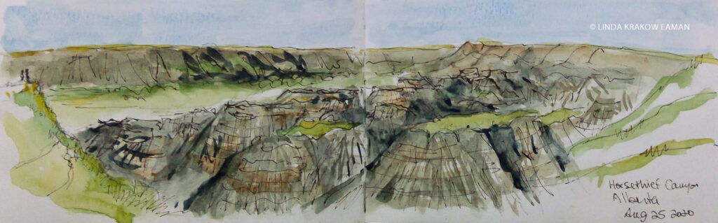
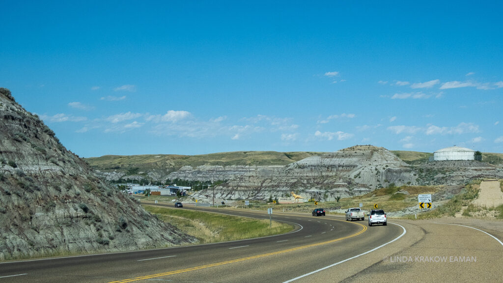
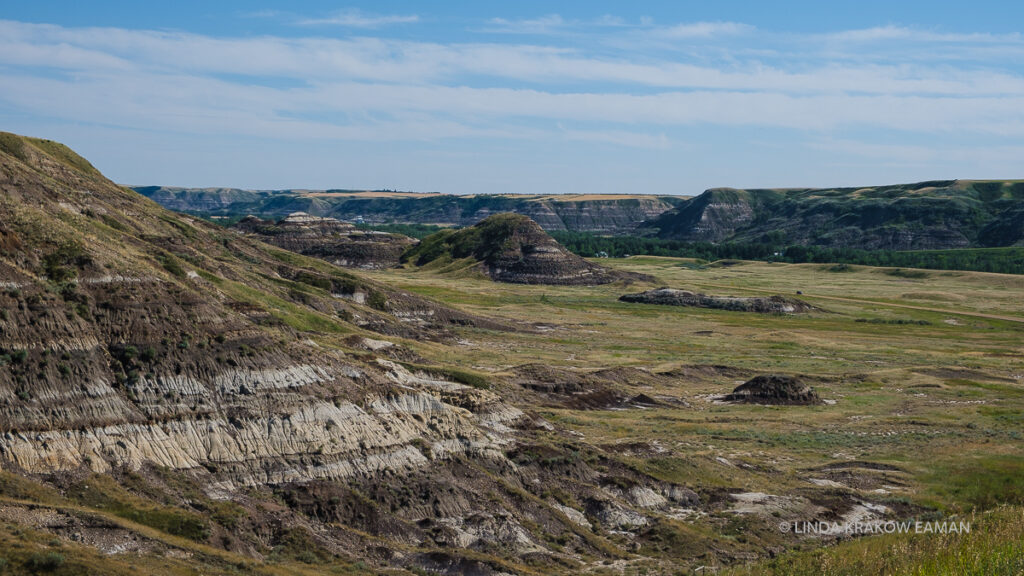
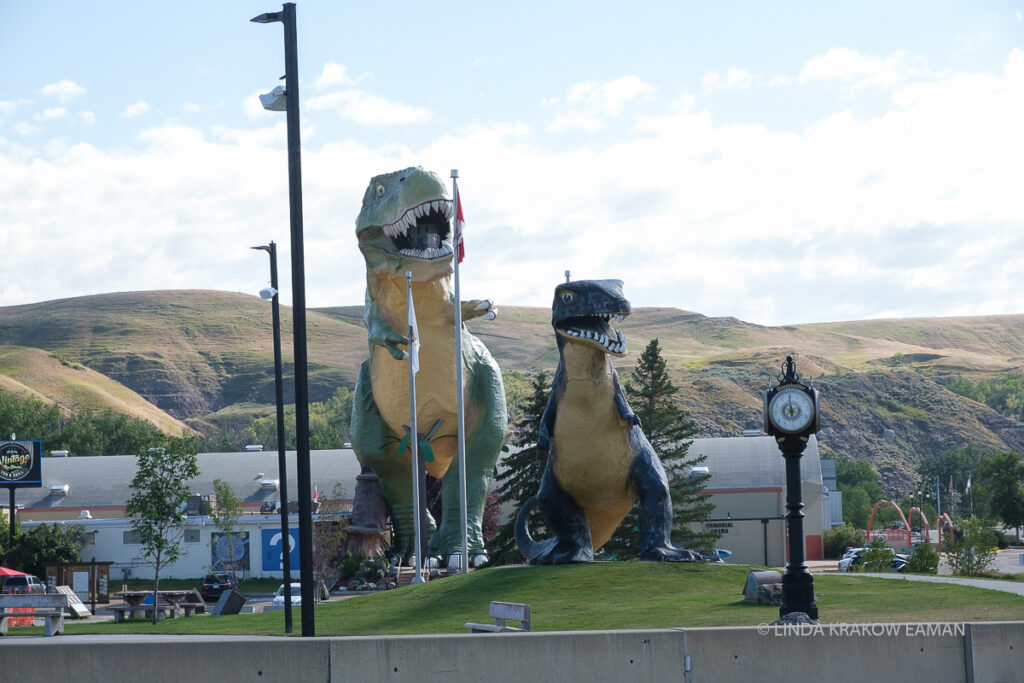
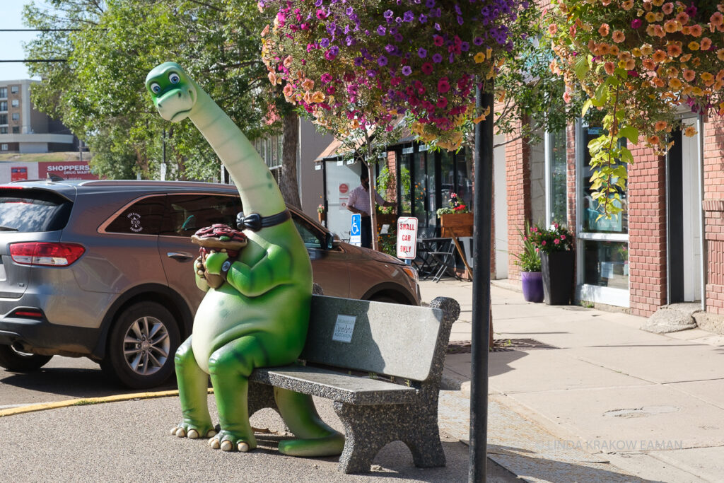
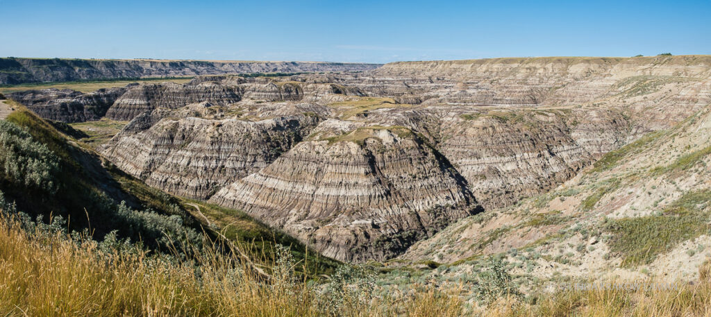
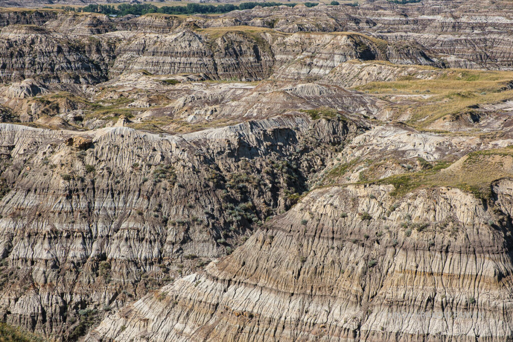
The countryside is quite flat, with fields of grain and lots of oil derricks. Entering the town of Drumheller, Alberta, you get a sense of what might be coming up! These are the badlands, in the Red Deer River valley. The area is rich in coal and dinosaur fossils. It’s desert-like, with short, sparse vegetation that includes the occasional cactus, along with rattlesnakes and scorpions.Badlands near DrumhellerDrumheller goes all out with the dinosaurs. There are dinosaurs on rooftops, painted on walls, on benches, in playgrounds, and in gardens. The “World’s Largest Dinosaur” in this photograph (26 m/86 ft tall, 66 kg/146,000 lbs) sits outside the renowned Royal Tyrrell Museum of Palaeontology. Horsethief Canyon, just outside DrumhellerI love the textures!
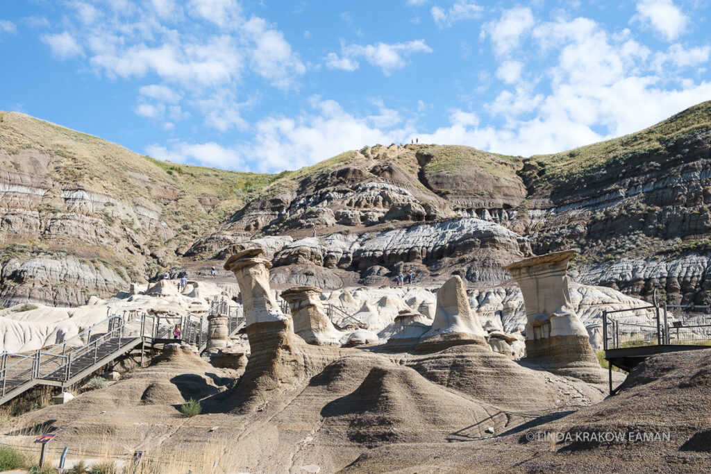
Nearby, the Hoodoos Trail is a beautiful spot, and the hoodoo formations are spectacular. Just be aware that photographs don’t always tell the whole story! I’ve included the wide angle here, so you can see that they’re not very big; there’s also a parking lot right next to them. However the ice cream/coffee truck in the parking lot is, in my opinion, a perfect touch. Affogato on a hot day… yum!
The black bands are coal. The area has a coal mining history and you can visit an old mine nearby.
Then on to Dinosaur Provincial Park. Another beautiful view of badlands, and a drive into the canyon for a picnic lunch. I regret not taking time for a hike!
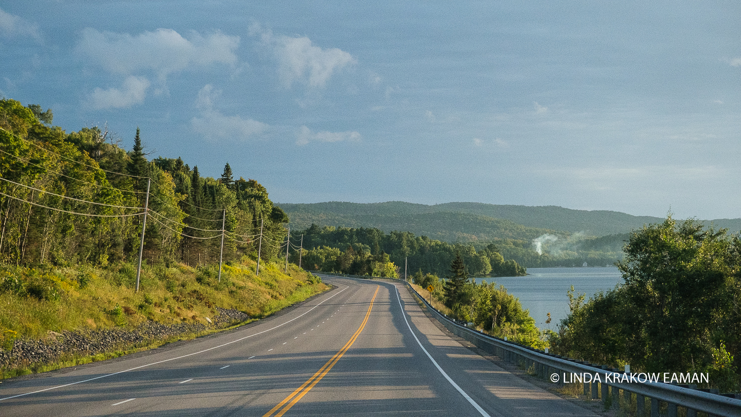
Next up: Cypress Hills. That meant heading south. Yep, first north, then south. By the time we got there we had been driving all day, and yet we were only about 80 kilometers further east. Not making great progress on that trek to Ontario, but you can’t miss this stuff!
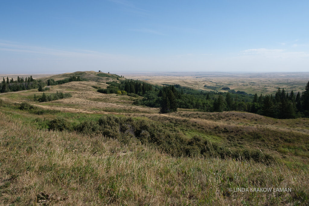
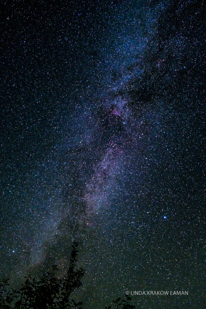
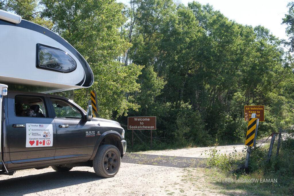
Millions of years ago, the prairies were covered in ice and Cypress Hills was an island. The park offers camping, water sports, hiking, and is covered in trees and lakes–a big contrast with the surrounding flat fields. This is a dark sky reserve and the stars are AMAZING! (For the uninitiated, these photographs do require some processing—the colours are really there, but not visible to the naked eye as you see them in photos. You do, however, see this many stars, and the milky band across the center of the sky.)Cypress Hills is an inter-provincial park spanning the Alberta-Saskatchewan border, and we entered Saskatchewan on a narrow dirt road. You might notice the sign on our camper. We were worried about how Canadians would react to our California license plates, since the border is closed to tourists because of the pandemic. Letting people know we’re Canadians moving home, we’ve quarantined as required, and we are traveling responsibly has been great—we’ve received lots of thumbs up and welcoming words.
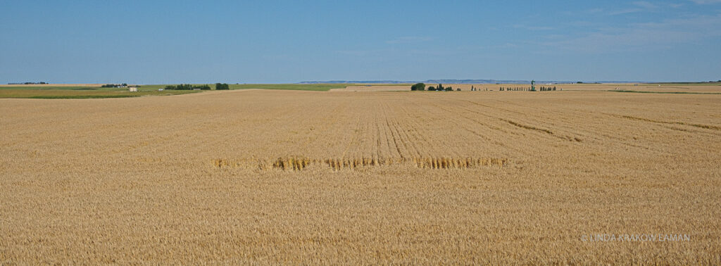
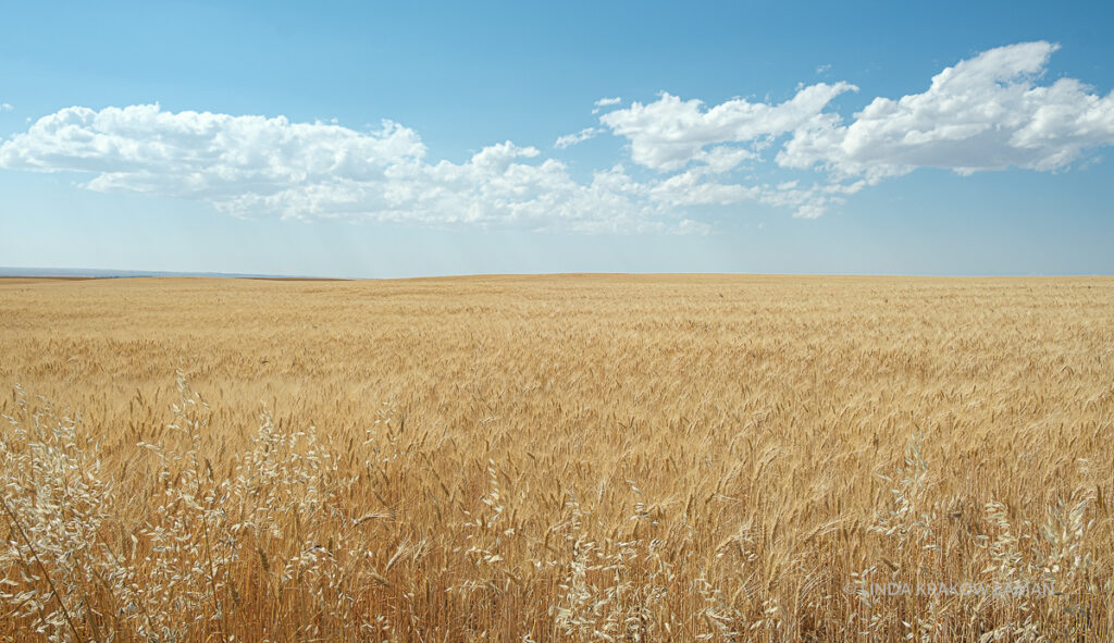
I am in love with Saskatchewan. Contrary to what I had heard, it is NOT a boring, flat monotony of wheat fields, especially if you get off the main Trans-Canada highway.
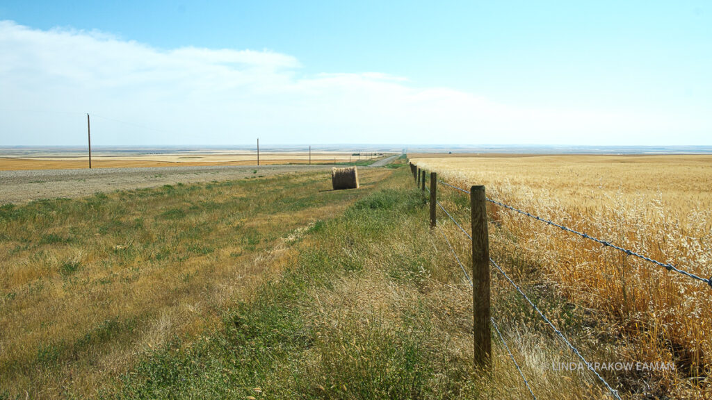
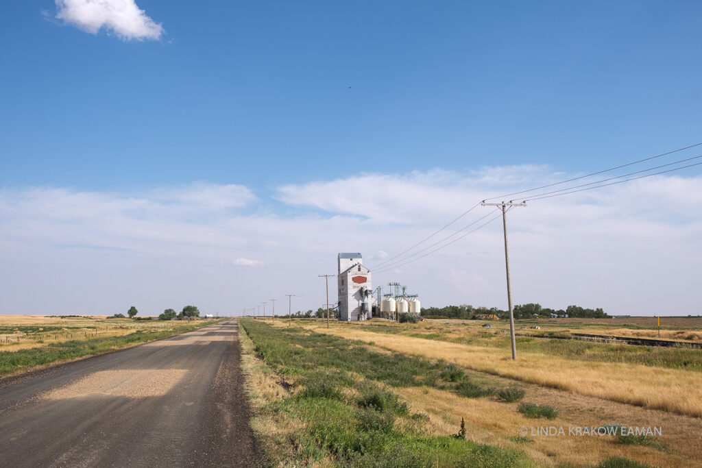
The fields (wheat, canola, barley) are really beautiful, and on the smaller roads you see lots of smaller farms and tiny villages.
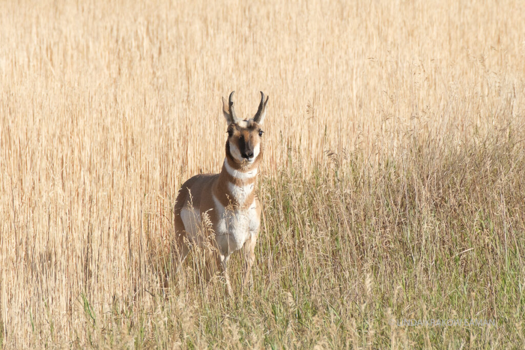
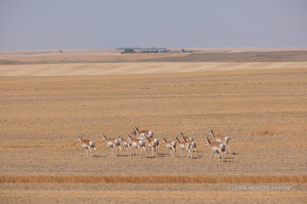
Pronghorn antelope roam the fields, and twice we had to wait for one to cross the road. They can run up to 100kph/60mph to escape coyotes.Along the Trans-Canada highway the grain elevators are massive structures with hundreds of rail cars alongside. But on the smaller roads they are picturesque. Many towns have two; an old one from the early 1900s, and a newer one.
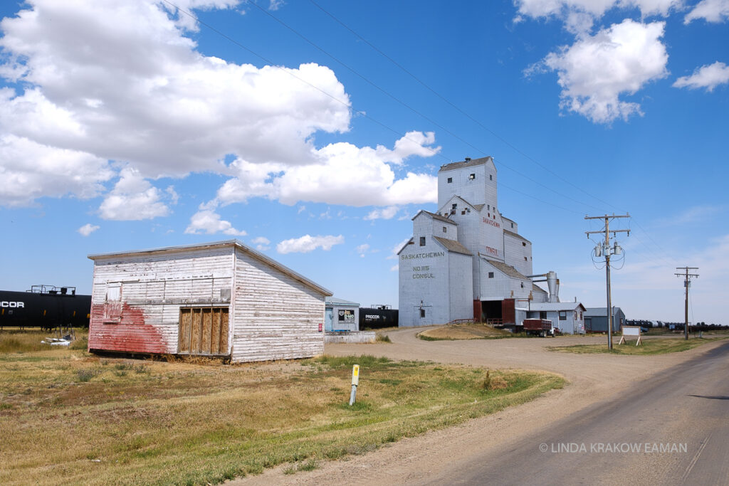
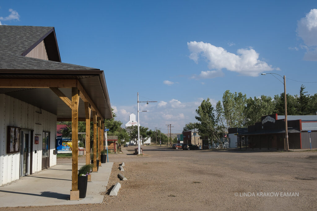
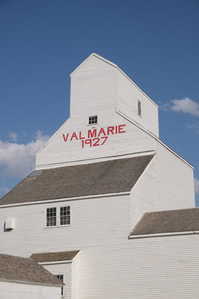
We spent a night at the municipal campground in Val Marie, population 130. It’s one of the many tiny villages founded in the early 1900s; some have very few businesses but here we saw a hockey rink (of course), post office, grocery store, restaurant, small museum (closed due to pandemic), etc. As the gateway to Grasslands National Park it usually sees a steady flow of people, but the lady in the store told me they were down 500 customers this month alone. Even areas that haven’t seen a case of Covid-19 are hurting.
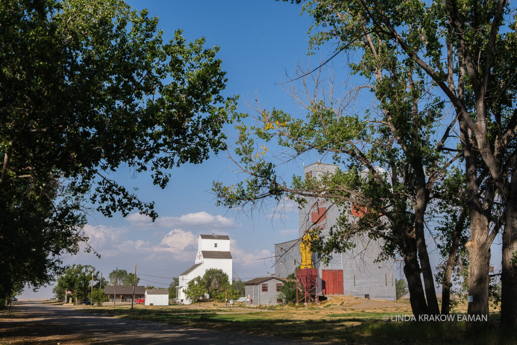
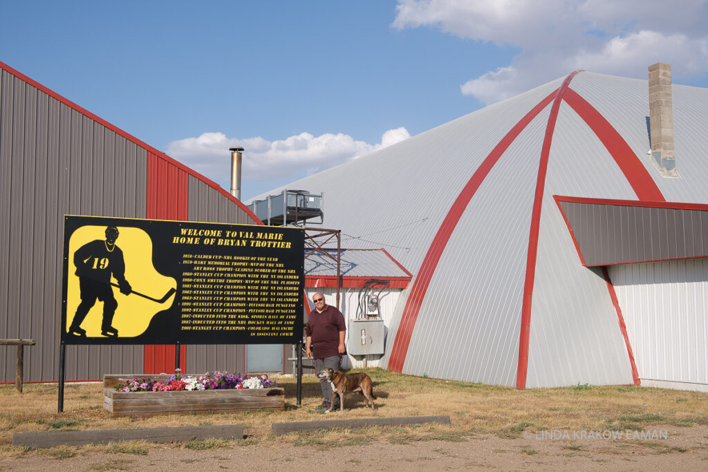
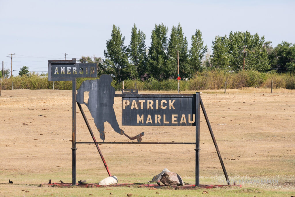
The main street of Val Marie, 1927 grain elevator at the end.Val Marie’s two grain elevators. The old grain elevatorA significant number of NHL hockey players are from Saskatchewan, and their home towns proudly display signs to that effect. I can see why; if you grow up in a town of only 130 people—and just about every town, no matter how small, has a rink—you probably get a lot of ice time! On that note, here’s one for my friends in San Jose. Aneroid is lovely and tiny–we saw a church, a small rink, and a grain elevator, but no stores and only a few houses.
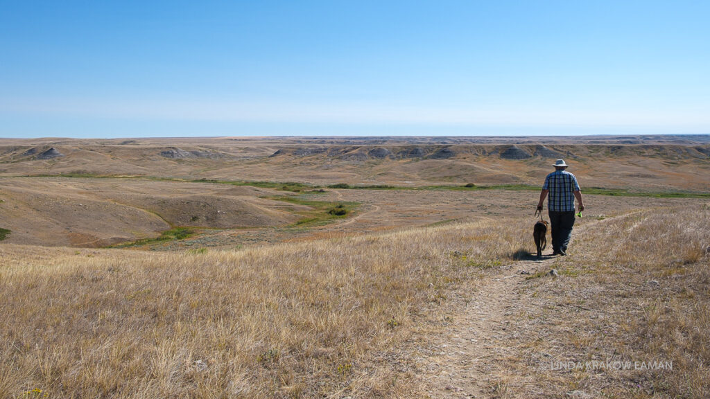
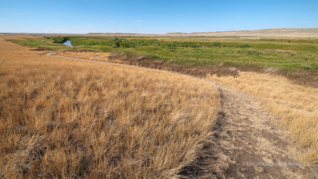
Grasslands National Park. O.M.G. I think I could spend a year here. It made me extremely proud to be Canadian! This is one of the last remaining areas of natural prairie in North America. Wide open spaces, big sky, wildlife… We were thrilled to discover we could get a same-day campsite in the park.
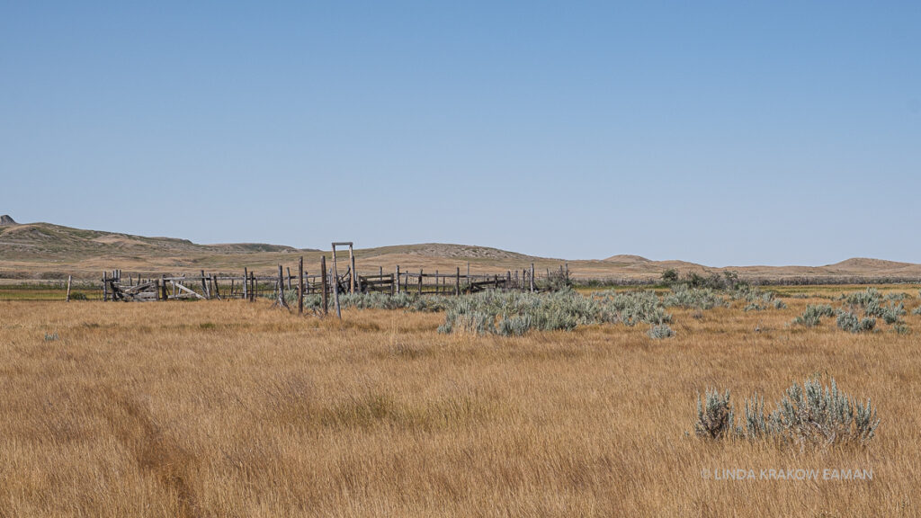
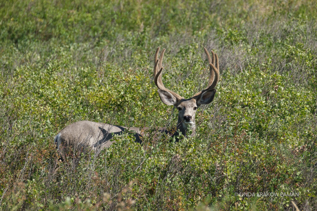
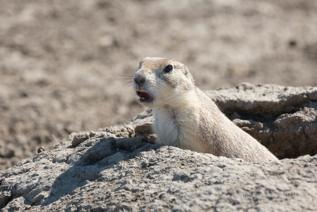
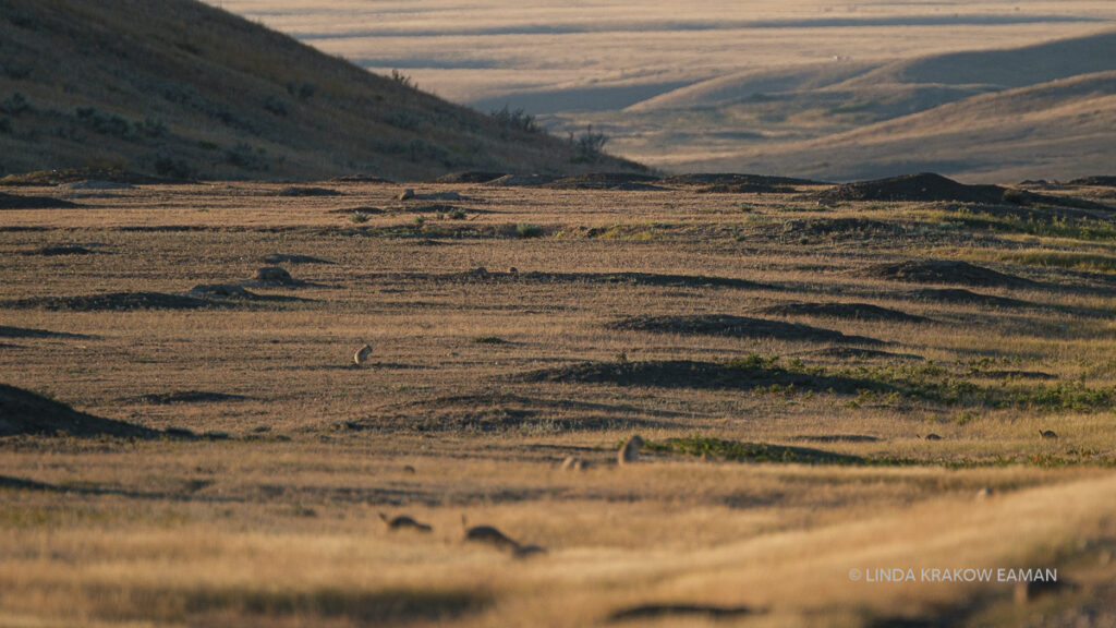
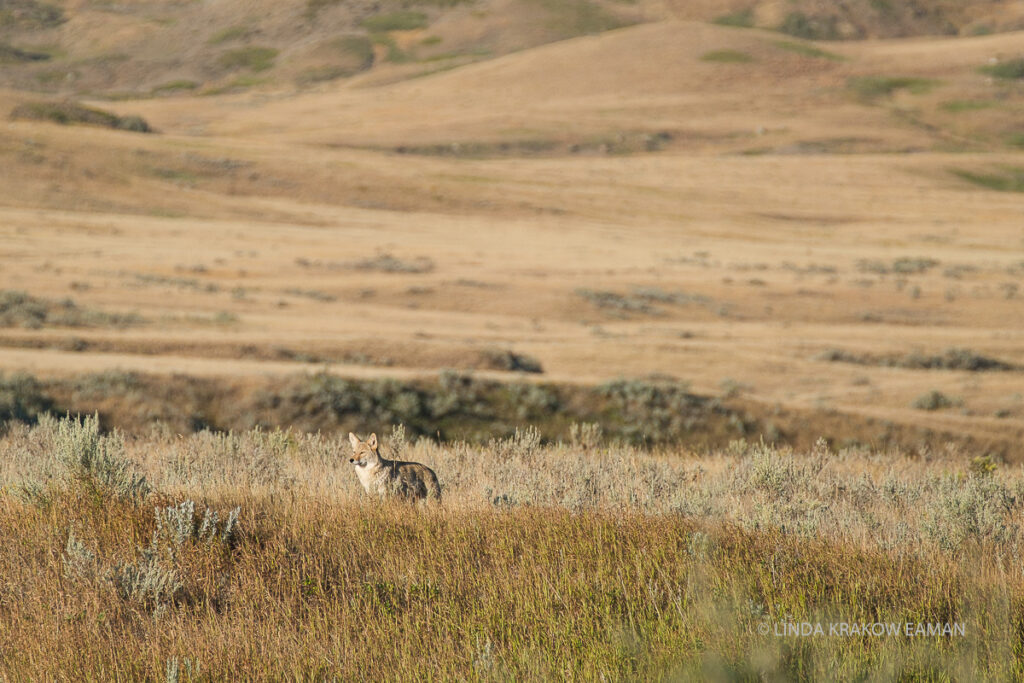
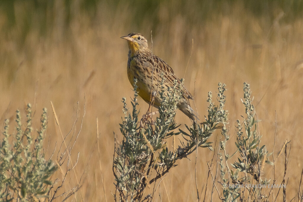
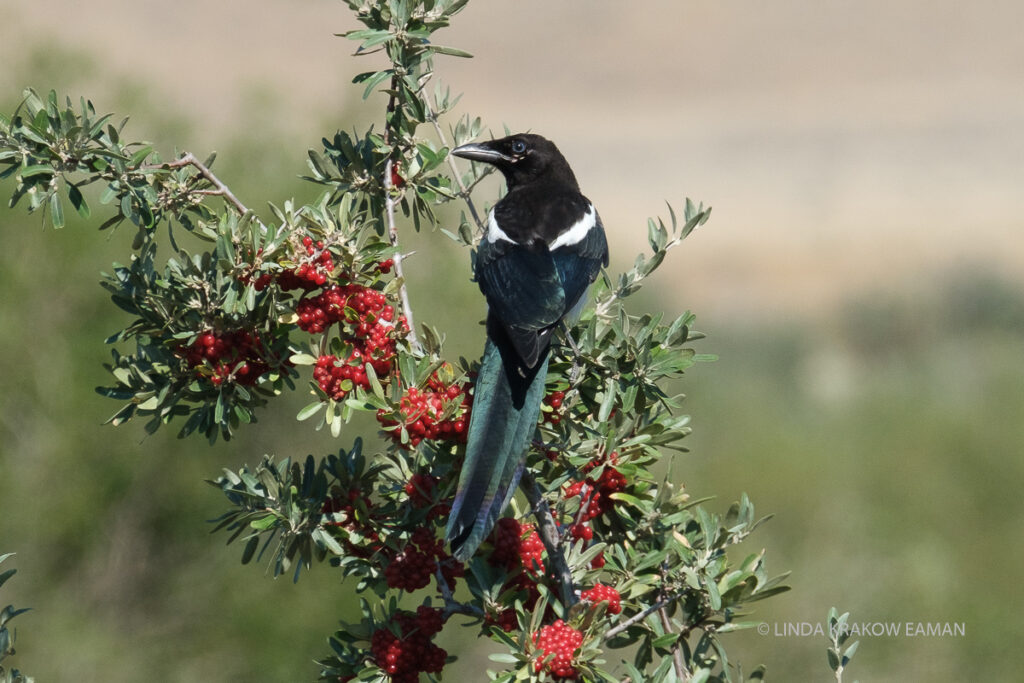
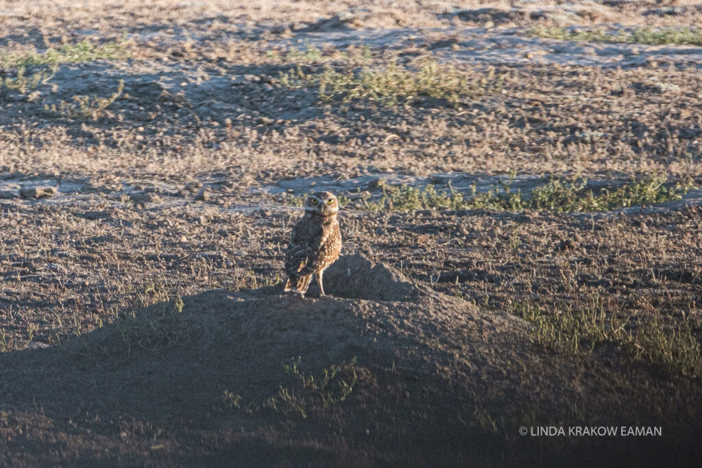
This is rattlesnake territory so we kept the dog on a short leash!The Frenchman River winds through the prairie in the park.In the 1870s there was a huge ranch here; the ruins of a few corrals and buildings are still visible. I find it fascinating to imagine what that life was like; the covered wagons crossing the bumpy prairies, the ranchers out on their own, bison roaming. And then there are the circles of stones that once held down the tipis made of bison hides. Before the white settlers arrived, the First Nations people lived here for thousands of years, in harmony with the land and the animals. There is still a remarkable richness of wildlife here, but the numbers are nothing like they would have been when the indigenous people were the only humans to share their space. A mule deerPrairie dogs! There are two prairie dog “towns” along the designated Eco-tour drive through the park, each with hundreds or maybe thousands of prairie dogs. This one is sounding the alarm—when one starts, the others pick up the refrain and soon the entire area is filled with the sound of prairie dogs barking. These two picked up the alarm when the first one started. Prairie dog town at sunset. Each of the mounds is a prairie dog hole.Coyotes are “top dogs” in the prairies, taking the place once held by prairie wolves. Western Meadowlark?MagpieThis is not a great photograph, but I am so ridiculously excited to have seen a burrowing owl that I’m sharing it with you. These little owls use abandoned prairie dog burrows, and the prairie dogs’ alarms alert them to any danger.
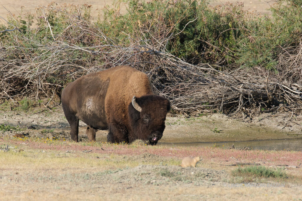
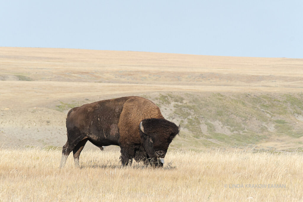
I’ve saved the best for last: bison! At one time, 30 million bison roamed North America. They graze freely in the park—we had seen a herd on the distant hills the day we arrived. But early the next morning we saw several fairly close. We watched one huge male using an information sign, where we had stood the day before, as a scratching post.
This guy was drinking at the water hole. I don’t think he has any interest in the prairie dogs, and the prairie dogs didn’t seem very worried about him.
With apologies (since it might get stuck in your head), I leave you with the refrain I found myself singing on an endless loop that morning:
Oh, give me a home Where the buffalo roam (well, technically they’re bison) And the deer, and the antelope play Where seldom is heard A discouraging word And the skies are not cloudy all day!
This was a fascinating blog, Linda. Your photographs are amazing as always and I love your descriptions. Thanks for continuing your travelogue through Canada. I regret never visiting there when I lived in Montana. I am eager to see the next segment on your journey home.
Wonderful descriptions of an area which fascinated me driving across Canada and your photos are amazing.
It is worth getting off the major highways and taking the roads less travelled to get a real feel of the prairies. Love your night sky photo too.
Happy to travel again via your blog.
Thanks Liz. We always like the roads less traveled. Sometimes the big ones are unavoidable though–we spent a lot of time on the wide, divided Trans-Canada highway, and that was definitely less interesting.
Love it! I have fond memories of the badlands, as our family drove across Canada and down to California (come to think of it – your route in reverse!) in our VW camper. My brother was crazy about dinosaurs, so we did check out that museum with the giant dino’s at the entrance. Great wildlife shots! The prairie dogs sound like squeaky toys!
Although I think the museum was open, we were being very cautious about traveling during a pandemic and had decided we would not do any museums. It’s supposed to be excellent though. I was really amazed by the prairie dogs’ alarm system, the way one starts up when it sees danger, and within a few seconds hundreds of them are on full alert and barking away.
Thanks for sharing your trip with us. The photos are fantastic! The Badlands look similar to those in South Dakota and prairie dogs can be seen all along the drive into Devils Tower in Wyoming. Interesting to see the similarities in different parts of North America. Safe travels.
The miles of wheat fields don’t look boring in your pics! What beautiful country – I’m so glad you have the time to enjoy it. I wondered of you’d see Marleau’s hometown. Thanks for the proof! Miss you!


Wonderful colourful travel blog! Feel like I’m in a western novel. Beautiful pictures.
This was a fascinating blog, Linda. Your photographs are amazing as always and I love your descriptions. Thanks for continuing your travelogue through Canada. I regret never visiting there when I lived in Montana. I am eager to see the next segment on your journey home.
Thanks Kim!
Just beautiful! Feel like I’m travelling with you or at the very least in a movie setting for a western! That picture of the night sky is incredible!
Thanks!
Wonderful descriptions of an area which fascinated me driving across Canada and your photos are amazing.
It is worth getting off the major highways and taking the roads less travelled to get a real feel of the prairies. Love your night sky photo too.
Happy to travel again via your blog.
Thanks Liz. We always like the roads less traveled. Sometimes the big ones are unavoidable though–we spent a lot of time on the wide, divided Trans-Canada highway, and that was definitely less interesting.
Love it! I have fond memories of the badlands, as our family drove across Canada and down to California (come to think of it – your route in reverse!) in our VW camper. My brother was crazy about dinosaurs, so we did check out that museum with the giant dino’s at the entrance. Great wildlife shots! The prairie dogs sound like squeaky toys!
Although I think the museum was open, we were being very cautious about traveling during a pandemic and had decided we would not do any museums. It’s supposed to be excellent though. I was really amazed by the prairie dogs’ alarm system, the way one starts up when it sees danger, and within a few seconds hundreds of them are on full alert and barking away.
Wow, gorgeous! I’m enjoying your trip vicariously but one day I’d like to get out there myself.
Thanks for sharing your trip with us. The photos are fantastic! The Badlands look similar to those in South Dakota and prairie dogs can be seen all along the drive into Devils Tower in Wyoming. Interesting to see the similarities in different parts of North America. Safe travels.
It’s a good reminder that borders are a human construct, isn’t it! Thanks for reading Jen.
The miles of wheat fields don’t look boring in your pics! What beautiful country – I’m so glad you have the time to enjoy it. I wondered of you’d see Marleau’s hometown. Thanks for the proof! Miss you!
I wish there was a way to do this without leaving our friends! I miss you too.
Wow! A good place to add to my bucket list! Thank you for sharing!